More

Guam Trip Builder

You have the following items saved in your itinerary. View Trip
Go
Go
menu icon close menu icon

Maps & Guides

We at Guam Visitors Bureau know that planning a safe and enjoyable trip is that much easier when you have as much information as possible to keep you and your clients well oriented and well organized. 

A wealth of information about our beautiful island is close at hand on this page. Guam Visitors Bureau is proud to offer you these maps and guide to help your group access our spectacular beaches, heritage sites, and venues with ease. 

Review them online or download and print them from the convenience of your office. 
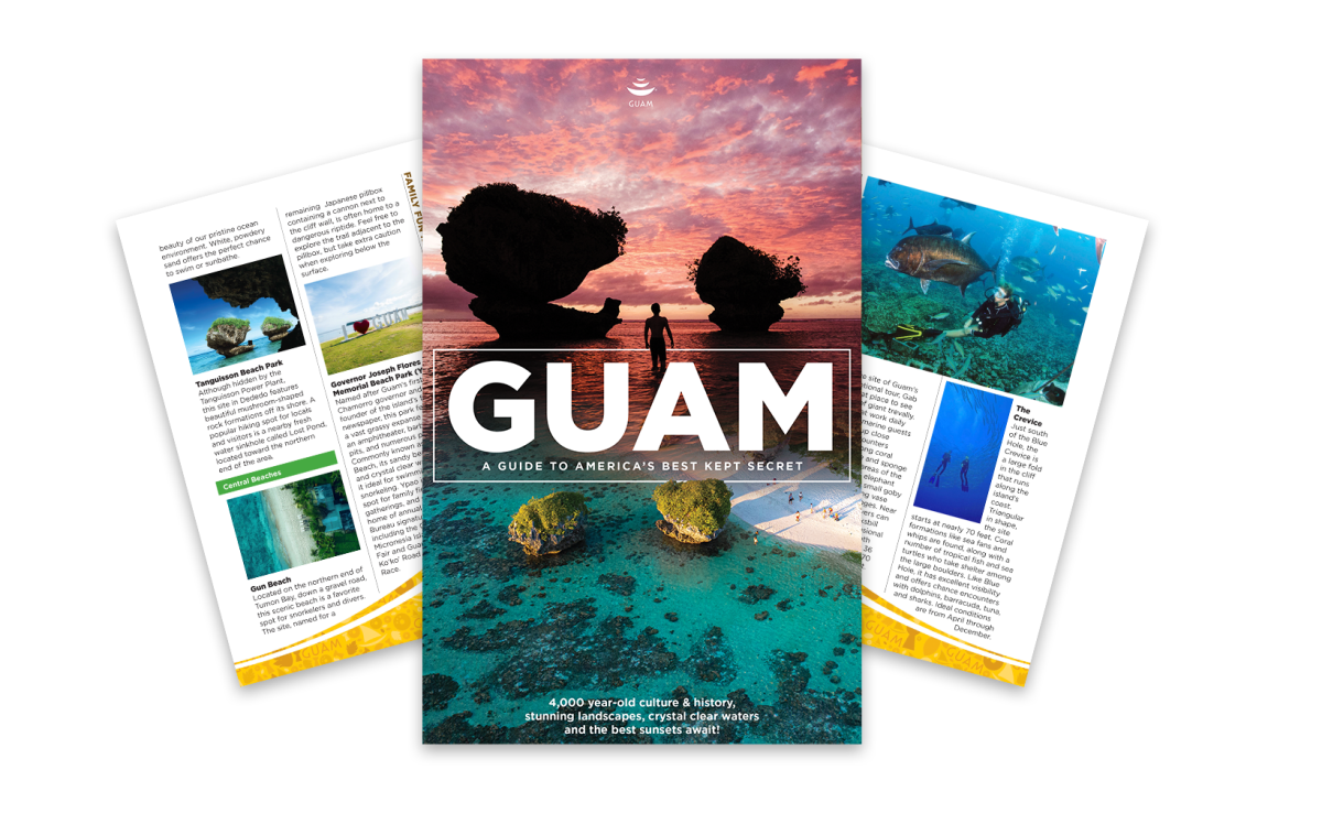
 

An overhead, stylized product mockup showcases three pages of a travel guidebook dedicated to Guam, fanned out against a clean white background with the front cover centered in the foreground and two interior pages angled behind it. The vibrant front cover features a dramatic pink and purple sunset over a tropical beach, highlighting distinctive mushroom-shaped rock formations in clear turquoise water, a silhouetted figure, and the prominent title "GUAM: A GUIDE TO AMERICA’S BEST KEPT SECRET" in bold white lettering. The partially visible left interior page, titled "Central Beaches," details local coastal spots like Tanguisson Beach Park, Gun Beach, and Ypao Beach using descriptive paragraphs and small coastal photos. The right interior page focuses on diving and marine life, showcasing vibrant underwater photographs of scuba divers alongside tropical fish and a deep chasm, accompanied by text detailing "The Crevice," a popular local dive site known for its coral formations and rich sea life.

This guide includes everything you need to know about our island in one easy-to-read format. From our rich CHamoru culture to our heritage, food, and even historical landmarks that make our island unique, you will find everything you need to explore our tropical paradise in these pages.  For your convenience, a downloadable version (PDF) is available.

Please fill out the form here, and a link will be provided for you to download the Guam Guidebook!
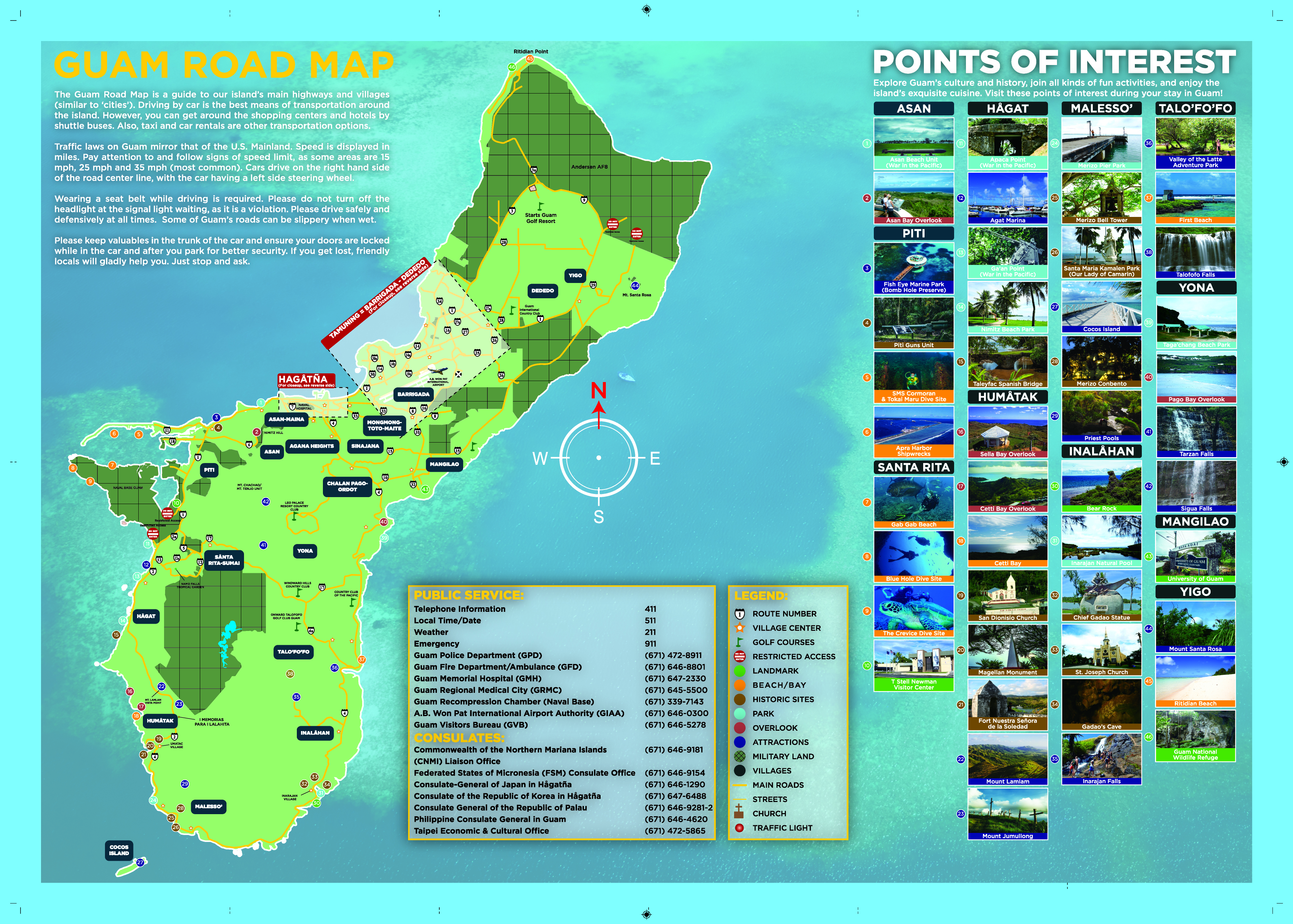
  • This image shows a colorful, comprehensive tourist road map of the island of Guam, featuring a large, green-shaded map of the island on the left side that highlights major roads, villages, and geographic regions. The center-bottom contains a large informational panel listing public service telephone numbers, emergency contacts, and international consulates, accompanied by a detailed map legend explaining icons for attractions, beaches, and historic sites. The right third of the poster is dedicated to a "Points of Interest" grid, showcasing numbered, captioned photographic thumbnails of popular destinations categorized by villages like Asan, Piti, Humåtak, and Malesso'. A decorative compass rose sits in the center-right of the ocean area, emphasizing the vibrant turquoise water background that surrounds the island layout.
     

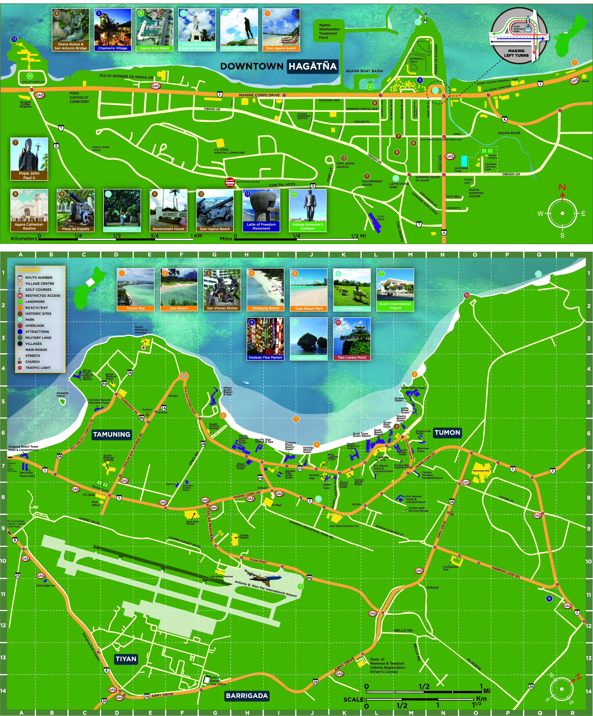
    This image is a detailed regional street map of Guam's urban centers, split horizontally into two distinct sections. The top half features an inset map focusing exclusively on "Downtown Hagåtña," tracing coastal roads like Marine Corps Drive and highlighting historic landmarks such as the Agana Cathedral-Basilica and Plaza de España with illustrative thumbnails. The larger bottom half consists of a detailed, grid-indexed street map (labeled A through R horizontally and 1 through 14 vertically) covering the bustling districts of Tamuning, Tumon, and Tiyan. This grid map clearly plots major thoroughfares, hotels, gas stations, and the Antonio B. Won Pat International Airport runway, bordered at the top by ten numbered photographic callouts of popular beaches and tourist parks.